
Million-dollar North Shore home unsafe just two years after completion! More homes are at risk than you might think…
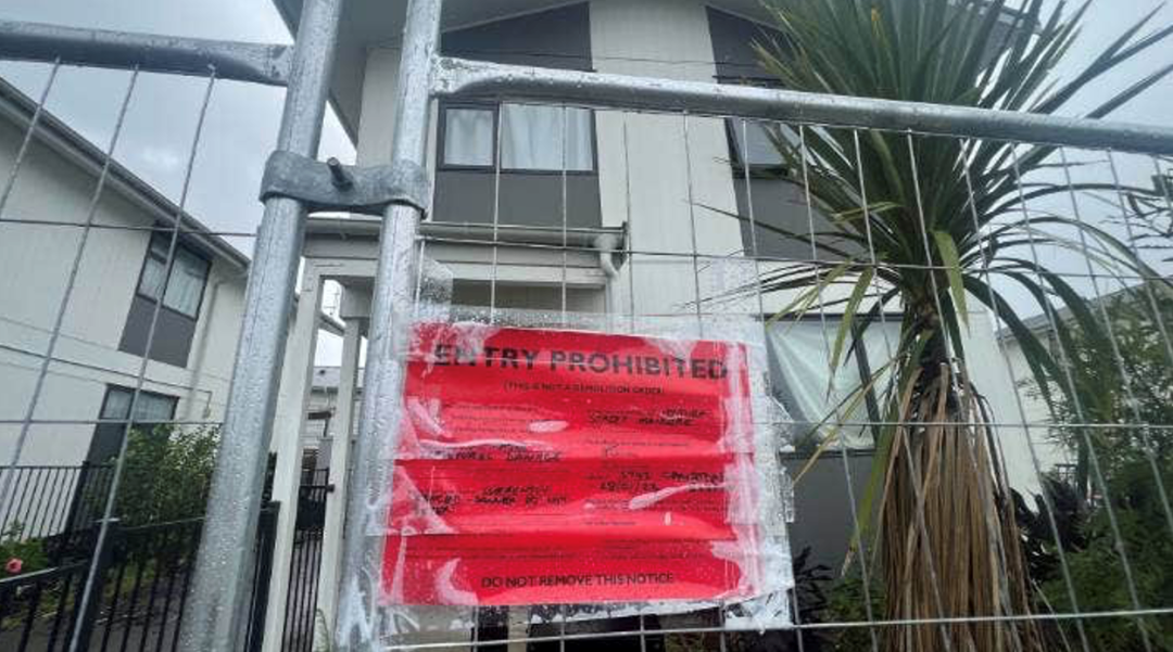
A luxury home on Auckland's North Shore, completed just two years ago, faces an extremely dangerous landslide and has already been red-stickered.
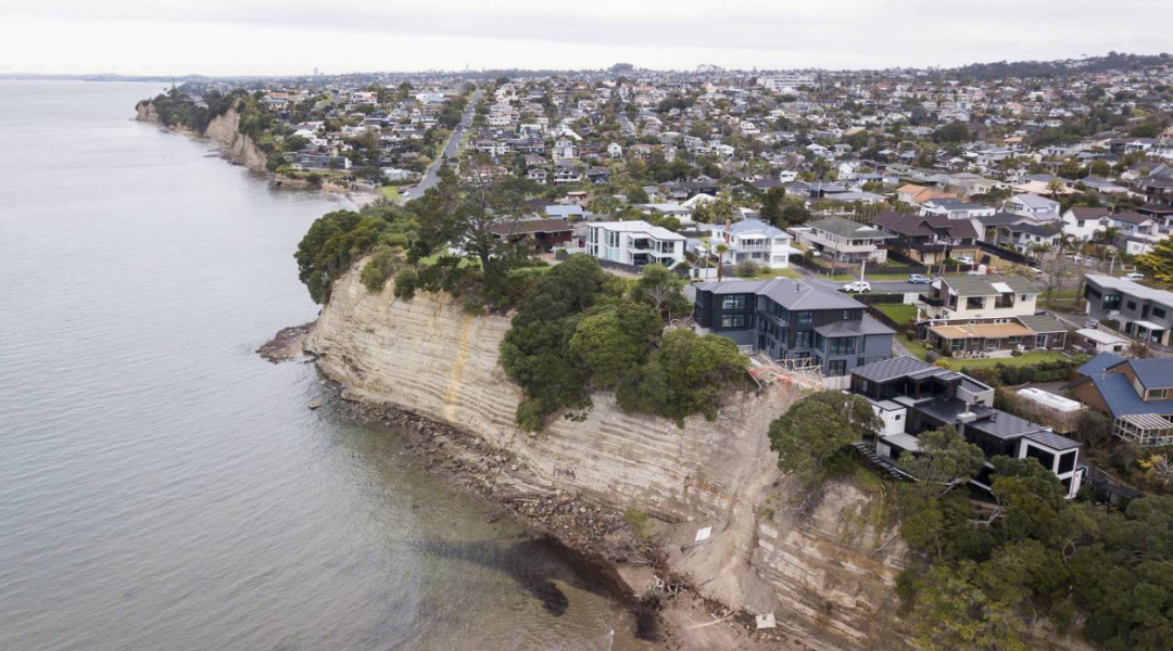
Following several floods in Auckland, more and more homes are at risk. In Auckland alone, 558 homes have now been red-stickered, prohibiting entry. Alongside flooding and leaks, many homes have also been hit by landslides.
A luxury home on Auckland's North Shore, completed just two years ago, faces an extremely dangerous landslide and has already been red-stickered.
Photographs show that the situation at this new NZ$2,250,000 home on Brigantine Dr has worsened since the 27 January floods. The property sits on a clifftop, and further slips have left its foundations and the retaining wall protecting the land exposed.
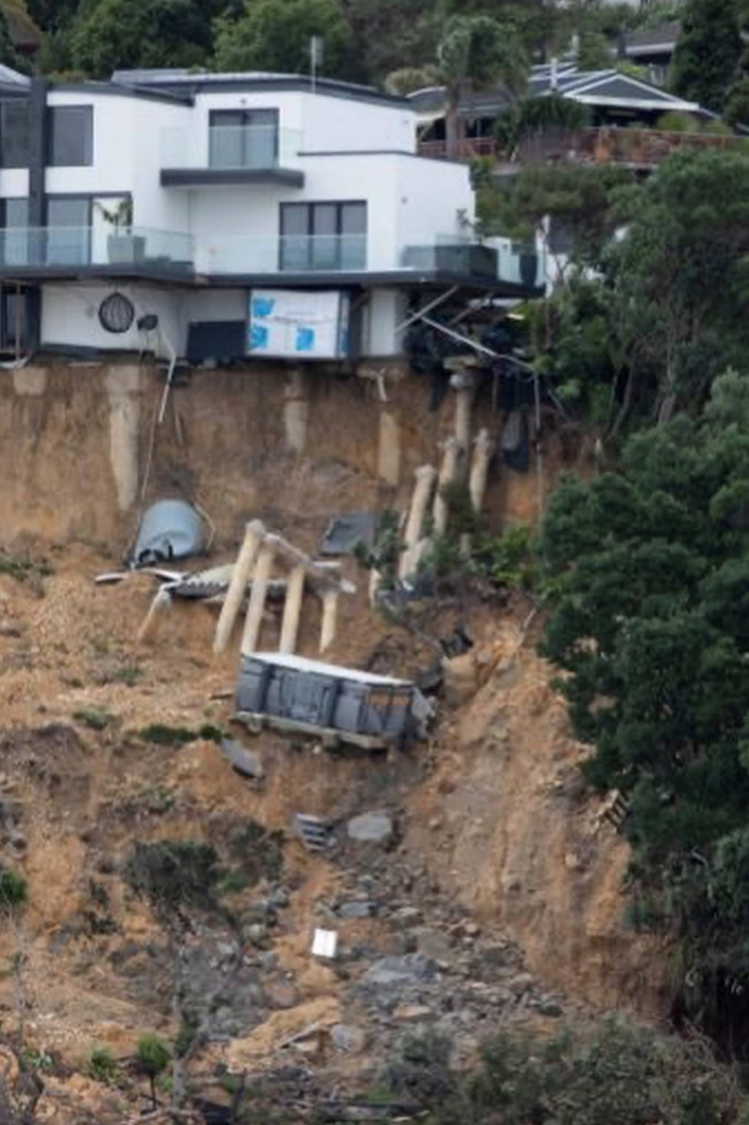
2023: the landslide following the 27 January floods
In fact, the house was completed at Easter 2021 and has since experienced repeated slips in the ground beneath it. Following heavy rain in November 2022, the cliff below the house collapsed.
Auckland Council's head of engineering resilience, Ross Roberts, said the fate of the new Brigantine Dr home remained undecided. Media reports suggest it could be demolished, although further attempts may first be made to stabilise the precarious cliff.
Roberts said a decision would take some time. “This will be a very challenging site, requiring complex and thorough geotechnical investigations to determine the most appropriate outcome.”
Following the collapse late last year, Auckland Council's compliance investigations manager Kerri Fergusson said the owners had not breached any rules and the cliff collapse was a natural event.
Roberts said weight was “unlikely” to have contributed. “The house should not have any effect on the cliff's stability because it is far enough away.”
{ad}
Auckland homes with sea views are vulnerable to coastal hazards
In fact, more coastal homes may face landslide risks than you might imagine. These properties typically have outstanding sea views and higher prices, making the losses even greater when disaster strikes.
Because of its distinctive geography, Auckland has New Zealand's highest ratio of population density to coastline, making it highly vulnerable to coastal hazards, including coastal instability and erosion. These hazards can pose safety risks, adversely affect property and infrastructure, and damage or destroy cultural and environmental sites.
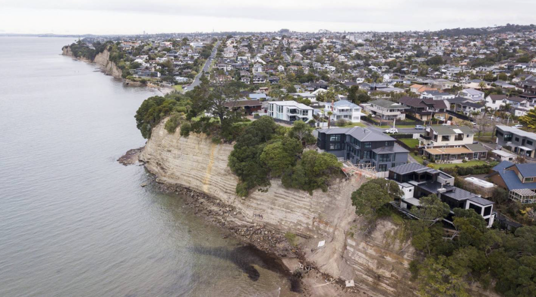
Homes on cliffs on Auckland's North Shore. Image credit: CHRIS MCKEEN
A 2020 council technical report edited by Roberts examined the risks of coastal instability and erosion. It stated that Auckland has more than 3200 kilometres of coastline, three major harbours, sandy beaches and hundreds of clifftop homes。
“Because of its exposed location, Auckland is highly vulnerable to the potential impacts of coastal erosion and flooding. While Auckland's exposure to coastal flooding is well understood and documented elsewhere, the risks posed by coastal erosion and the associated instability are less clear.”
As many as fifty thousand Auckland homes are in flood zones
If landslides and floods are beyond homeowners' control, what should we really be reflecting on? Are there problems with the approval and planning of our housing developments?
Statistics show that Auckland has 55,000 homes in flood zones, many of which were inundated in the recent floods.
Since the start of 2016, Auckland Council has approved the construction of 9220 new homes on flood plains, areas through which waterway runoff flows, and 4295 homes in flood-prone areas, such as depressions and gullies through which rainwater flows.
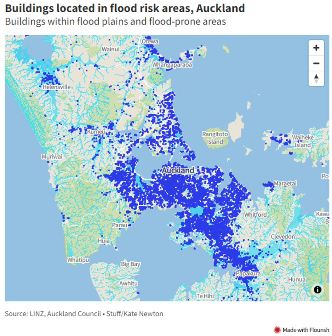
These flood-vulnerable areas are scattered throughout Auckland, with safety and danger sometimes only a street apart. Around Eden Park in central Auckland, for example, almost half the streets are identified as at risk, while other homes face no risk. Following the recent Auckland floods, observations by local residents and others indicated that the flooded areas closely matched the flood risk maps.
In 2019, Diane Tieni happily moved with her children and grandchildren into a newly built Kāinga Ora state home in Māngere West, south Auckland. What she did not know was that this was one of Auckland's lowest-lying areas, meaning the development lay almost entirely within a flood zone. The construction industry knew the area's risks, and ground stabilisation was required before new homes could be built.
On 27 January this year, Diane watched as heavy rain almost destroyed her property. Floodwater entered the house, flowed over the carpets and soaked into furniture. The basement flooded, and the entire ground floor was submerged in a foot of water.
Unlike the older homes, hers had been completed less than 4 years earlier. She said the biggest mistake was building on a flood plain.
A Māngere home red-stickered after the floods
Asked whether development in flood zones should continue, Climate Change Minister and Green Party co-leader James Shaw gave a one-word answer: “No.” So if everyone, from residents, stormwater engineers and climate researchers to politicians and community advocates, is so clear about this, why does it keep happening?
Shaw said: “There are probably many reasons. One is that central government has not directed local councils to refuse approval for building on flood plains. With a housing crisis, councils are under pressure to expand the housing stock, and I think some of them make those trade-offs.”
Legal reforms are currently under way, but they will not resolve what to do about existing homes in flood zones.

Climate Change Minister and Green Party co-leader James Shaw.
Image credit: Mark Mitchell
Auckland could be hit hard again at any time by the next “once-in-a-century” downpour. As ordinary residents, we can take steps to reduce our own exposure to risk.
The simplest way to identify whether a property is in a flood zone is to check its documents. In New Zealand, local authorities hold a document called a LIM, or Land Information Memorandum, for every home. It records information relating to the property, such as:
- Special characteristics of the land, such as whether the property is in a flood zone or potentially threatened by landslides;
- The locations of private and public stormwater and wastewater drains, which must be considered for future extensions or subdivision;
- Any outstanding charges on the land, including unpaid taxes, penalties and other amounts;
- Information about buildings on the land, usually including house plans and details of alterations.
Before buying a property, it is advisable to read the LIM to understand the home's particular circumstances and make an informed decision.