
A flood map sparks a NZ$60,000 dispute: models and reality diverge as debate over Auckland property risk intensifies
On an Auckland Council flood risk map, a 1565-square-metre site in St Lukes is clearly marked as a ‘potential flood area’.
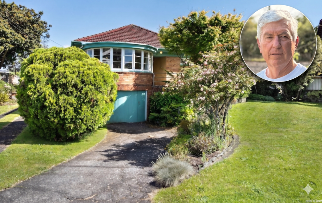
On an Auckland Council flood risk map, a 1565-square-metre site in St Lukes is clearly marked as a ‘potential flood area’.
But its owner, Rob Sherrell, disagrees with that conclusion.
Over the past few years, he has spent approximately NZ$60,000 on drilling, infiltration testing and geological analysis, all to prove one thing: the site will not flood.
This is more than an isolated case. It is a practical problem many homeowners may face: when an area-wide model conflicts with evidence on the ground, which should the market believe?
A site that ‘looks as though it will flood’
Sherrell bought the New North Road site in 2020. The old house itself had limited value; what attracted him was the land’s characteristics. Zoned for high-density development, it offered a familiar investment proposition: selling it to a developer in future.
But a map presented a problem.
According to the council’s earlier flood model, the site lies within the extent of a ‘one-in-a-hundred-year’ flood, with an annual probability of 1%. A future building consent application would be likely to result in a Section 72 notice on the title.
The industry understands what such a notice means: insurance may be restricted, development becomes more complex and buyers gain greater bargaining power.
Sherrell did not accept that assessment.
He brought in engineering consultants to carry out repeated tests, examining boreholes, soil structure and infiltration capacity, even extending the work to neighbouring KiwiRail land, to establish whether water would actually accumulate there.
The conclusion was clear: even under theoretical ‘one-in-a-hundred-year’ rainfall conditions, the likelihood of serious ponding on the site was very low.
Putting the model to a real-world test
What really escalated the dispute was Auckland’s Anniversary Day deluge in 2023.
That rainfall was considered more intense than the model’s ‘one-in-a-hundred-year’ event. According to the model, water should have reached a depth of 300 to 500 millimetres at the site’s lowest point.
The reality was very different: observations on site recorded only about 50 millimetres.
“It looks as though it will flood, but it actually won’t,” Sherrell said. “The issue lies in the structure of the ground beneath it, rather than the surface.”
In his view, the extreme weather itself provided the most direct real-world test.
The map remains unchanged, and the label stays
Sherrell subsequently submitted the full technical report to Auckland Council.
The council did not simply reject it. It acknowledged that the current flood extent in the area ‘may be overestimated’ and could shrink following a future update. Ultimately, however, the site remained classified as a ‘low-risk flood area’.
For Sherrell, this has moved beyond a technical issue to a tangible loss.
The property is currently valued at approximately NZ$1,975,000, with the house accounting for only a small share. Its main value lies in its development potential. Once labelled a flood risk, that potential is discounted.
“If it won’t flood at all, then that loss of value is unfair,” he said.
More than an isolated case
Similar disputes are occurring beyond St Lukes.
In Glendowie, homeowner Stephanie Burgess also questions the accuracy of the flood maps. Her house has never flooded, yet the system identifies it as being in an ‘area susceptible to ponding’.
She believes the council uses a broad, one-size-fits-all model in which the risk depends on a combination of extreme conditions that rarely occur in reality.
But the market does not make such fine distinctions.
As a property professional, she knows that once a flood warning appears on a LIM report, many buyers simply steer clear without even investigating the risk level.
In Bayview on the North Shore, the situation goes further. An entire residential neighbourhood has been classified as a ‘very high hazard’ flood area, leaving residents concerned about insurance, lending and restrictions on future extensions as well as house prices.
Some describe the designation as an invisible red card attached to a house.
The council’s explanation: An area-wide assessment, rather than a conclusion about an individual property
In response to the criticism, Auckland Council has maintained a consistent position: flood maps are not drawn for individual properties.
They are an area-wide risk tool based on catchment modelling that considers rainfall, terrain, drainage systems and other factors. Their purpose extends beyond alerting buyers to risks; they also support infrastructure planning and urban design.
More importantly, the law requires the council to disclose known natural hazard risks, and this information must appear in LIM reports.
Why, then, do the maps differ from reality? The explanation is relatively straightforward.
Most current models still use LiDAR terrain data from 2016. Although it can achieve centimetre-level accuracy, it reflects the land as it was then, rather than changes from subsequent development.
New data from 2024 has already been collected and the models are being rebuilt, but updating them progressively takes time.
At the heart of the issue are models based on consistent standards, legal responsibilities and risk management on one side, and homeowners’ assessments based on site testing and experience of actual weather on the other. The two do not entirely conflict, but they are difficult to align completely. During the lag before models are updated, the market is magnifying this grey area.
Property values are being redefined
For homeowners, however, these differences ultimately translate into prices. A designation on a map can affect insurance, lending, development approvals and even a buyer’s first impression. In other words, flood maps have become more than information: they are a pricing tool influencing the market.
As disputes of this kind continue to emerge, those working directly in the market are increasingly noticing the effects.
In an interview, experienced Bayleys Remuera real estate agent Lonny Tian said such situations were far from uncommon in actual transactions.
“To be honest, I have a lot of sympathy for these owners. We have encountered quite a few similar cases in our work: houses that have never actually flooded, but are classified as being in a flood zone in the city council’s system.”
In his view, current flood classifications look more like the result of an area-wide approach than assessments of specific properties.
“School zones offer a useful example. Some houses do not show up on the wider map, but can be individually listed and confirmed as being within the school zone,” he said. “A similar mechanism could be considered for flood zones.”
Lonny Tian suggested that, where existing large-scale models cannot be adjusted quickly, the council could consider a more flexible approach to individual cases.
“For example, if an entire street is classified as a flood zone, but one property has undergone comprehensive geological testing and drainage assessments and had no problems during previous heavy rain, could its owner be allowed to submit those reports and apply for an individual update or clarification?”
In his view, even if the wider area cannot be reclassified immediately, individual properties could at least receive a clear designation.
“For example, if properties from number 1 to number 10 are all in a flood zone, but a professional assessment establishes that number 10 has no risk, could it be marked separately? That would be fairer for the market.”
However, he also cautioned that assessing risk cannot be reduced to a simple either-or choice.
“Conversely, a house outside a flood zone is not necessarily safe. Some houses may not be marked but could still have a history of ponding.”
His advice to buyers was direct: “Don’t just look at the map. Ideally, visit the property during heavy rain so you can feel more confident about its actual condition.”
For sellers, he believes communication remains essential.
“Owners can communicate more with the council. We also hope there will be a clearer process in future, such as an ‘exemption’ designation for properties that genuinely have no flood risk and have professional reports to support that, giving the market a clearer reference point.”